
Fly into Cyril E. King Airport
The airport sits on the south coast west of Charlotte Amalie. Build in time for baggage, taxi queues, rental pickup, road traffic, and a steep final approach to hillside lodging.
Cyril E. King Airport, taxis, rentals, cruise piers, Red Hook ferries, and steep island roads
Cyril E. King Airport sits west of Charlotte Amalie on the south coast. St. John ferries commonly depart from Red Hook on the east end, while cruise passengers use harbor-side facilities. Confirm the exact terminal and allow for traffic, baggage, weather, and left-side driving.
Cyril E. King Airport, Charlotte Amalie, Crown Bay, Red Hook, and the island's steep-road connections
South-coast arrival points connect across steep central hills toward the north shore and east end. Compare Cyril E. King Airport, Charlotte Amalie, Crown Bay, Red Hook, and Magens Bay before choosing where to stay or arranging a transfer. Lines show island travel corridors rather than turn-by-turn road geometry; confirm the exact terminal, current traffic, ferry schedules, weather, parking, and left-side-driving conditions before departure.
The airport sits on the south coast west of Charlotte Amalie. Build in time for baggage, taxi queues, rental pickup, road traffic, and a steep final approach to hillside lodging.
Taxis remove the first-day driving learning curve. A rental adds flexibility for beaches and viewpoints, but also left-side traffic in mostly left-hand-drive vehicles, tight curves, parking, and steep roads.
Red Hook and Charlotte Amalie are different terminals. Check the operating carrier, departure point, ticketing, baggage rules, weather notices, and return sailing directly before leaving.
Second Star gear guide
Long Flight Comfort
Long-flight packing list
Keep medication, charging cables, a light layer, water-bottle access, and the first-night essentials in the carry-on. Delayed bags are easier to absorb when beachwear and one clean change stay with you.
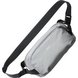
Compact Travel Sling Bag
$95.00
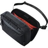
Tech Organizer Sling Bag
$55.00

Portable Travel Power Bank
$22.49
Official resources
Airline schedules, terminal operations, ferry departures, fares, baggage rules, road work, and weather can change.
Keep exploring
More great destinations to pair with this trip


